The knight who wanted out: Llanthony and the border ridge
The day
Elevation
Distance and ascent are computed from the published GPX track (ascent from its terrain-model elevations, at a 3 m smoothing threshold), not rounded from guidebooks. The plan view and the profile are drawn from that same track: they show the shape of the day, not a navigable map.
The route in 42 seconds
The story
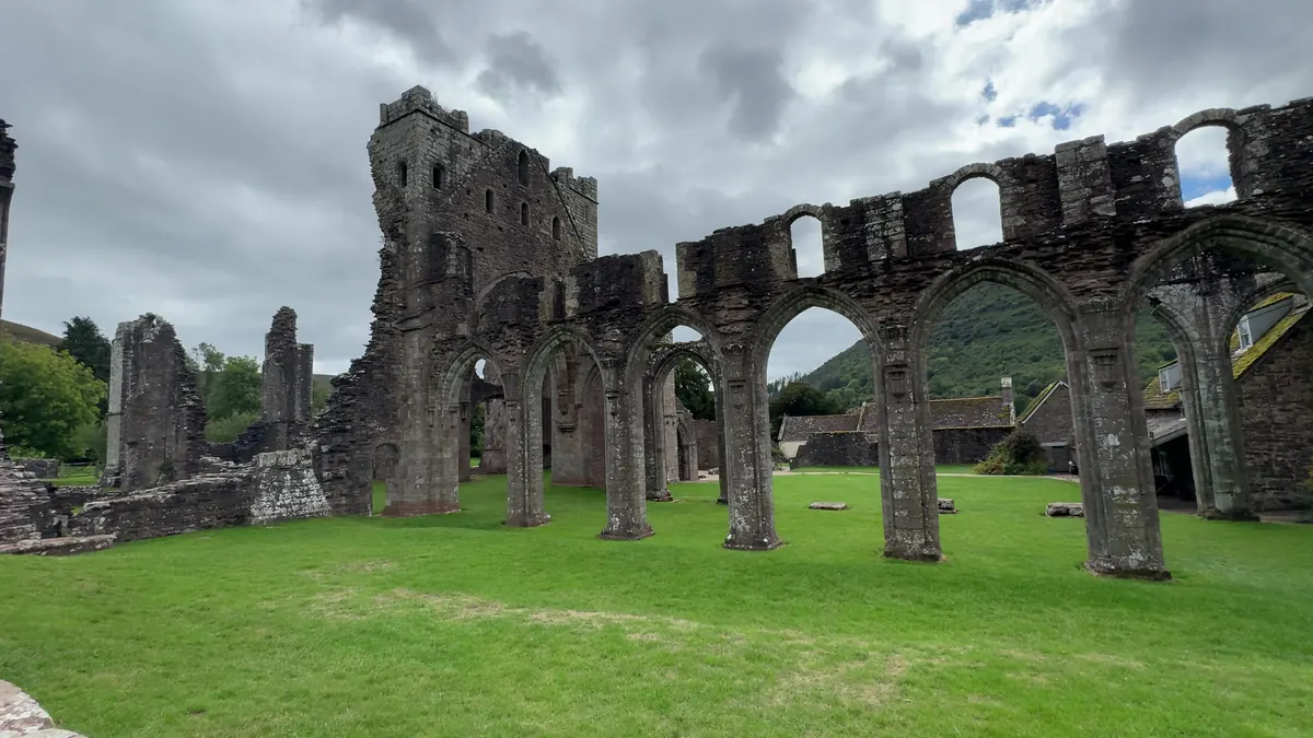
About nine hundred years ago, the story goes, a Norman knight called William de Lacy rode up this valley, found a ruined chapel, and decided he was never leaving. He hung up his sword and lived here as a hermit. That part is legend, and it is told a few different ways, but what grew out of it is standing stone you can walk through.
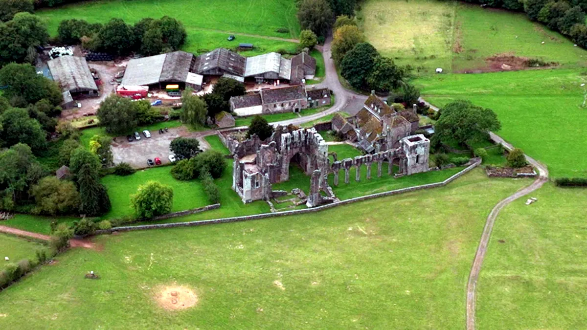
The church here was consecrated in 1108, and by about 1118 it had become a priory of Augustinian canons, the first house of the order in Wales. Canons rather than monks, strictly: I said monks on camera and asked to be corrected, so consider this me correcting myself. They were Normans in a Welsh valley at a bad time to be either, the Welsh made life hard for them, and most of the community withdrew to Gloucester, where they founded a second Llanthony. What you see now is the later church, roofless, with the arches of the nave still marching down the lawn.
The walking
From the priory the route climbs east onto the ridge by an old path locally called the Beer Track, Rhiw Cwrw in Welsh. The story is that it carried beer over the border. That is local tradition rather than documented history, but the name is real, and it is a good pull to start the day on.
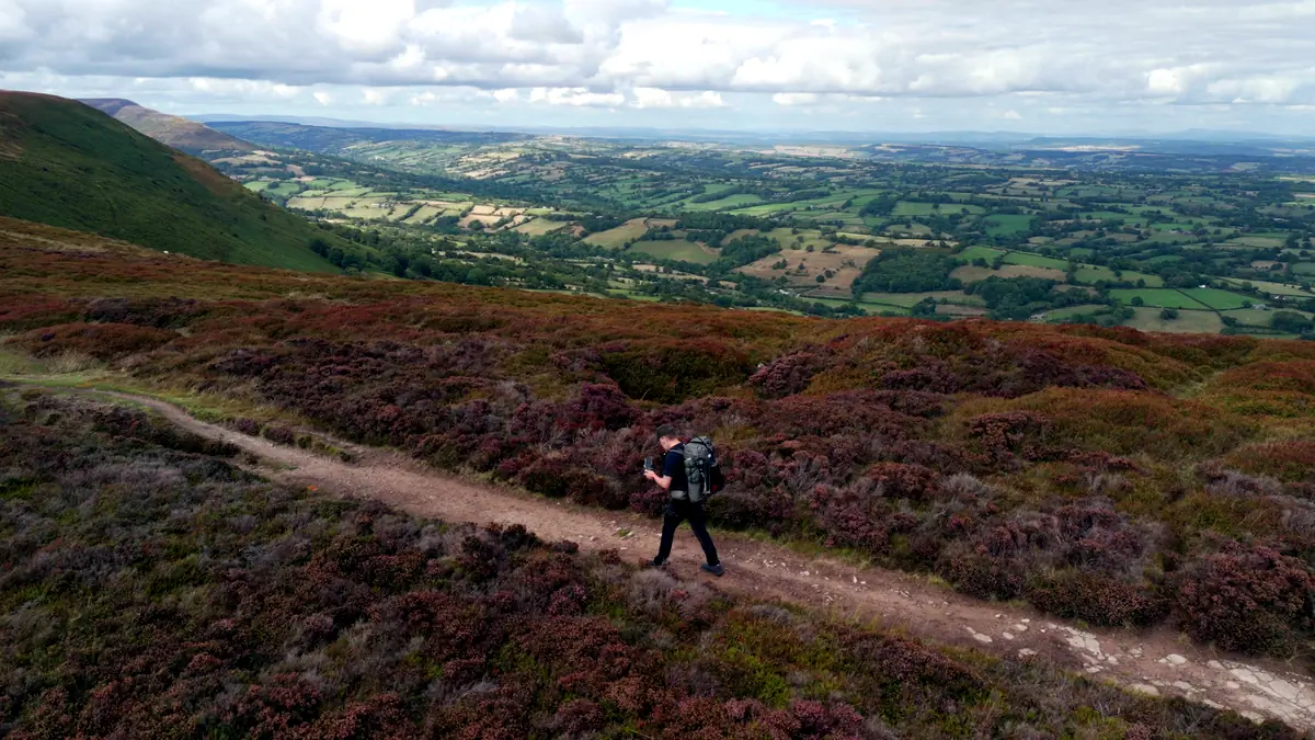
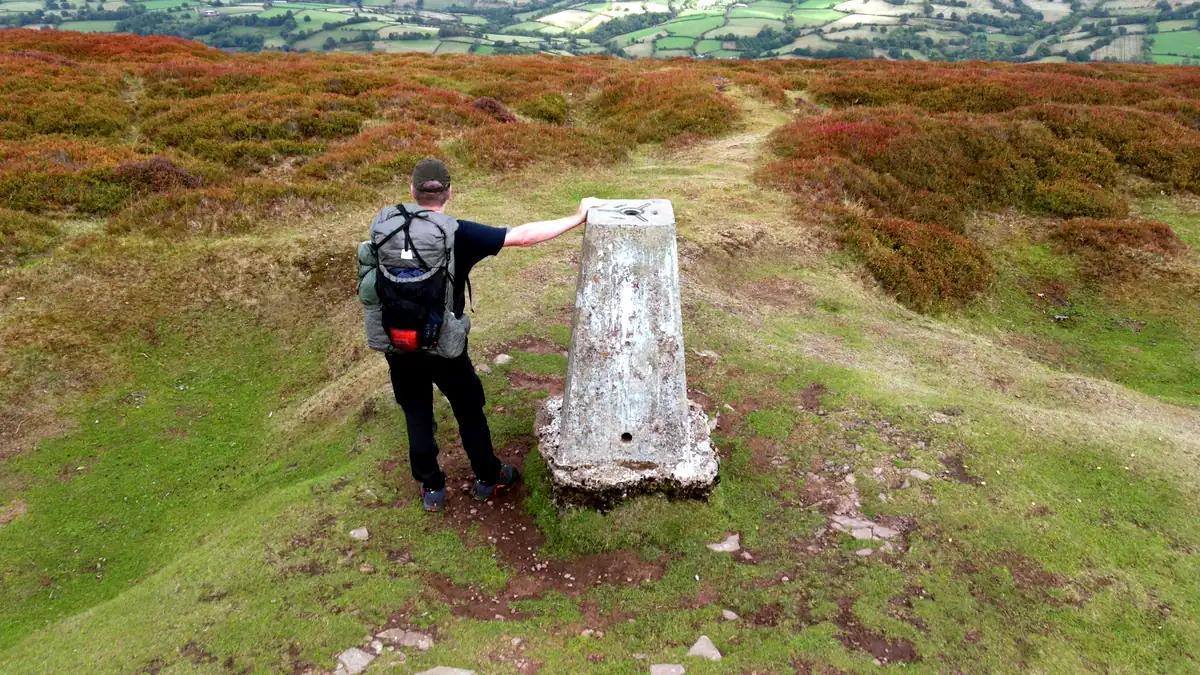
At the top you are on Hatterrall Ridge, on the Offa's Dyke Path, with Wales on one side and England on the other. The border runs along this ridge. The dyke itself, built in the eighth century, mostly runs through the lower ground, so up here you are walking the border rather than the earthwork. The ridge is heather and peat, wide and flat on top, and the path heads north along it for most of the high section.
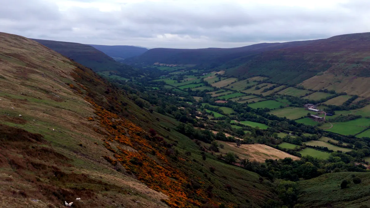
Look west and you get the other half of the day. The Vale of Ewyas was carved out by glacial ice, which is why its sides are so steep and its floor so flat: the same process that cut the edges above Llyn y Fan Fach, which I walked for the Bronze Age cairns film.
The trig pillar on the ridge is the obvious place to stop. You will probably share the top with sheep and with the hill ponies that graze up here.
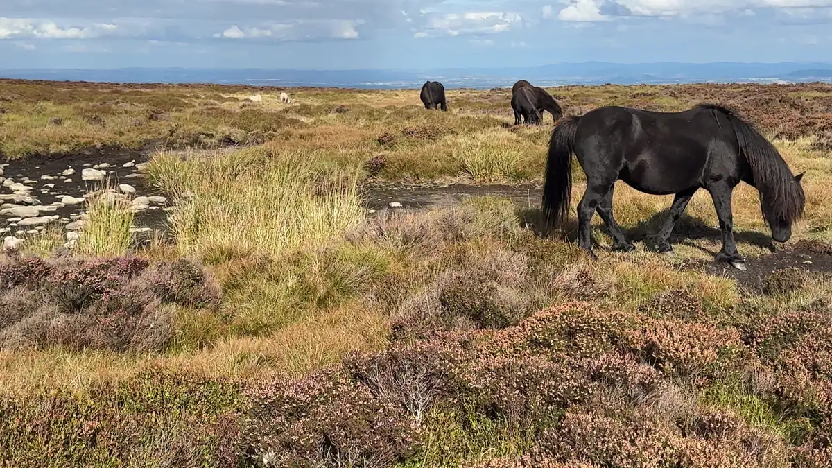
Water is the thing to plan. This is sandstone country, so the valley runs with streams, but the ridge top is flat peat with nothing you would want to drink. I dropped off the ridge to a spring for mine, and still treated it and filtered it: a small, clear spring is lower risk to start with, but in sheep country you can never see what is upstream. Clear water is not the same as safe water. Either collect on the way up or plan a detour like mine.
The camp
The night was up high, with the valley going gold below and the Milky Way overhead once it got dark. Dinner was a mushroom risotto, cooked sitting in the grass. The film has the evening and the night sky properly.
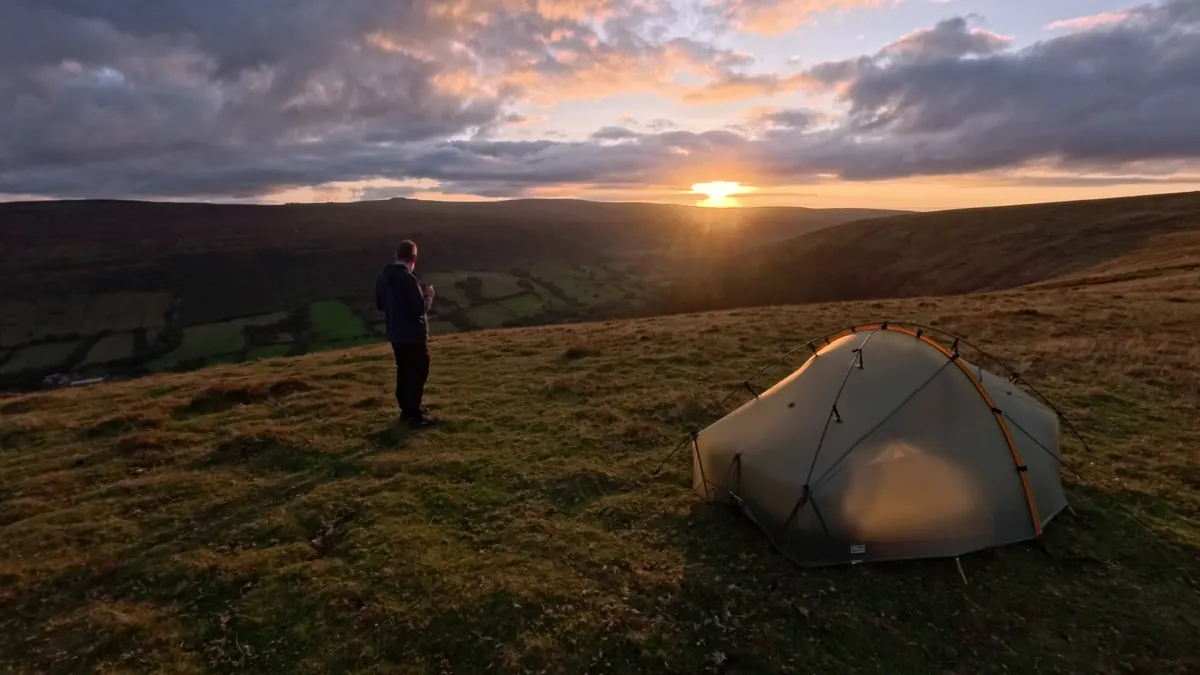
I am not going to point to where I pitched, on this or any other page. Find your own spot, pitch late, keep it small, be gone early and leave nothing. The leave-no-trace guide has the rest.
Capel-y-ffin
The descent off the ridge is steep and zigzags down towards Capel-y-ffin, which means the chapel on the border. Its little chapel of St Mary was built in 1762, and it sits in a ring of old yews. The Victorian diarist Francis Kilvert knew this valley and described the chapel squatting "like a stout grey owl among its seven great black yews". The yews are still there, and so is the owl.
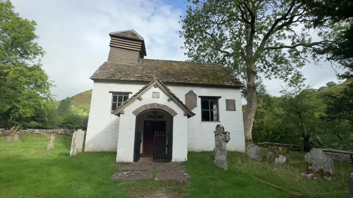
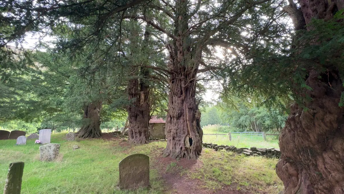
From the chapel the route follows the valley back south to Llanthony. It is gentler walking than anything else on the day, which is just as well by then.
Practical notes
The walk starts and finishes at Llanthony Priory (SO 288 278), where there is a car park by the ruins. The priory ruins are in the care of Cadw and are free to walk around.
Navigation on the ridge is the real hazard. The Offa's Dyke Path is a clear line in good visibility, but the top of Hatterrall is broad, flat and featureless, and in cloud it becomes map-and-compass ground. It is also boggy after rain.
On the way down, before Capel-y-ffin, there is a rest stop that someone has made on their own land for walkers passing through. It is private and it is generous, so please treat it gently. The film shows it.
Wild camping is not a legal right in Wales. Where a night like this sits with the law, and how the quiet convention works, is in the law guide.
Filmed for the Jim's Wild Trails channel. If you walk it, tell me what I missed. Corrections welcome: social@jimswildtrails.online.
Also on this site: Bronze Age cairns and wild camp on the Black Mountain west and the Wellington MF509 bomber wreck on Carreg Goch. Planning your own night out? Start with how I stay safe on an overnighter, the kit I carried, and the rest of the guides.